Paddlers Corner: Enjoying the Waters Around North Saanich
by Johanna de Leeuw
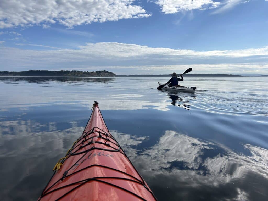
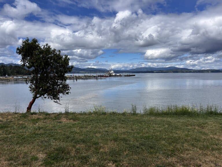
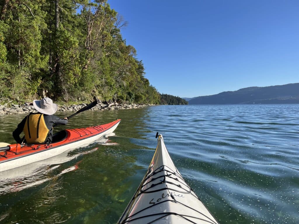
Summer is a beautiful time to be paddling our pristine waters around North Saanich. With the promise of warmer temperatures in the week ahead, light winds forecast and currents in our favour, let’s plan for Russell Island from Moses Point on Wednesday morning. We have the last of an ebb to assist us in the crossing from Moses Point towards Cape Keppel and the paddle along the wilder south side of Salt Spring Island, followed by a flood beginning just before noon to help us on our return journey.
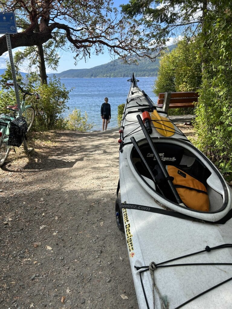
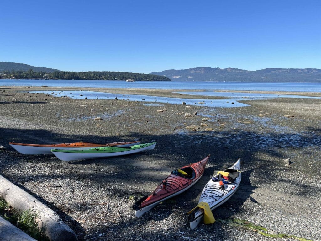
You will need your wheels to follow the path from the road to the launch at the small beach on Moses Point. We will lunch at the little sandy beach on the west end of Russell Island and follow with the always enjoyable hike to historic homestead. If we circumnavigate the island before lunch, the journey there and back is approximately 10 nautical miles. We will need to keep an eye on the ferry into Fulford Harbour when crossing from Isabella Point. Wind, Tide and Current (Sansum Narrows) forecasts are listed below…
 Pulling boats to Moses Point on wheelies
- Coles Bay/Ardmore
- Venturing north, east side of the Saanich Inlet
- Towards Sidney, James Islands
- James Island
- Brentwood Bay
- Coles Bay direction
- Moses Point
- D’Arcy Island/Haro Strait

How fortunate we are to be living in an area where emails such as these from one of my paddling groups arrive two or three times weekly in my inbox. ‘Paddlers Corner’ is the first of future articles on paddling in our area where knowledge and ideas of our kayaker’s haven and gateway to the Gulf Islands can be shared and explored. The focus in this issue will be geared towards the novice paddler: Getting Started (kayaks, paddles, safety gear); What to wear (our waters are cold so immersion wear recommended); What to know before you get on the water (winds, tides, currents); Where to go (the best spots for scenic sheltered paddles around North Saanich); Close encounters (watch those ferries!); Belonging to a kayaking organisation. Each of these headings could yield an in-depth multi-page discussion on its own. For now, this issue offers a brief overview of each topic to get the ball rolling.
Getting Started: Kayaks, Paddles, Safety gear
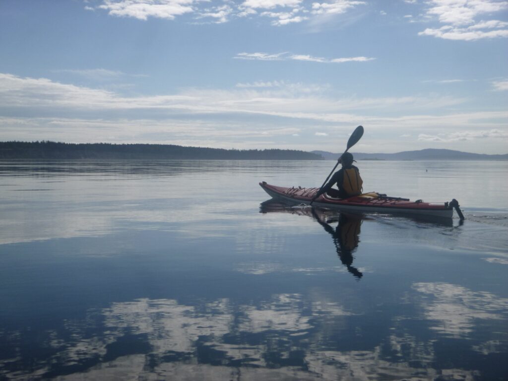
Kayaking responsibly in our waters can seem daunting at first. If you want to do more than play in a plastic Pelican in sheltered waters close to shore (Coles Bay, Chalet Beach Deep Cove, Towner Bay are good options) and go further afield, there is much to consider. But once you are on the water with all you need, you will be rewarded with ocean experiences unique to being in a small, self-propelled craft close to natural wonders.
If you have never kayaked before, the best way to begin is to choose a reputable kayaking company that can supply you with all the gear you need, offer introductory tips, lessons or a guided paddle in a safe environment. One of several such companies on the Saanich Peninsula is Pacifica Paddle Sports located in Brentwood Bay which has a location right here in North Saanich at Canoe Cove. This is the best way to determine what kind of ocean-going kayak is best for your level. Becoming familiar with the equipment and safety gear you need is the most important step. Transport Canada requires certain safety items for kayaks: PFD, whistle, spray skirt, heaving line, bailer or pump. A reboarding assist such as a paddle float is highly recommended since many novice kayakers may not be able to clamber into their boat in the event of a capsize. Useful information on safety gear can be found at Mountain Equipment Company.
What to wear
It’s a brilliant sunny day on the Saanich Peninsula with warm temperatures in the low twenties, water dancing with sparkled diamonds calling out to you. What could be better than to jump into your kayak for a serene paddle along the shores or out to a small island? But wait! If you are thinking of ocean waters, it is important to be aware that though we are located in the warmest part of Canada, our ocean waters are never warm with average temperatures ranging from 8 -12 degrees. Pick up any real estate magazine and you will be invited to purchase property where you can launch your kayak from your backyard or nearby beach. As alluring as this is, for even the most casual local paddle, immersion wear clothing is an essential safety item and will protect you from potential hypothermia should you accidentally capsize.
There are many options for paddling wear, but for a beginner or first-time paddler, and during the warmer months, all you need is a wetsuit or neoprene layer. Neoprene works by trapping a thin layer of water against your skin and using body heat to create an insulating barrier that slows down heat loss. It has the added benefit of providing extra buoyancy should you find yourself in the water and even protects you from the odd scrape from our rocky shores. There are varieties of options and styles such as sleeveless farmer Jane/John suits, top and bottom separates, or shorty wetsuits that come in varying levels of thickness with 2-3 mm being the standard. A snug fit is important. There is a wide variety of retailers offering types of neoprene that provide different levels of comfort such as Reed Chillcheater’s Aquatherm (compressed and lightweight) and NRS Ultra suits (water shedding inside layer), so it pays to shop around. Paddling boots and gloves are essential comfort additions. Paddling apparel is available from excellent retailers in Victoria and Oak Bay area.
What to Know: Winds
There are many mornings in the summer when we look out over calm waters under a blue, sometimes cloudless sky and think, what could go wrong? Often a day of paddling ends the way it began, calm and beautiful. There are other times when unexpected changes occur especially with wind speeds and direction, resulting in unpleasant, sometimes unsafe conditions. A prepared paddler is a happy paddler and it is easy to be prepared. Taking the time to consult the many useful wind, tide and currents apps is not only essential, it will set you up safely for that special experience on the water you crave.
The first thing I do when thinking of a paddle, no matter how short or casual, is to look at the winds. A kayak is a beautiful, flexible and comparably lightweight craft but being only human powered, it (and we inside it) are at the mercy of what nature provides. Another way of looking at it is to use nature to our advantage. Instead of fighting the wind, why not choose a day where the wind will either provide some assistance or at least not go against us. In fact, as novice kayakers, we should not consider paddling in winds of more than 10 nautical miles an hour (19 km/h, see Paddle Canada Water Classifications). More than that requires hard work and also learned skills. Winds can also change direction as well as speed during a paddling time window. Wind Apps, while not infallible, have become amazingly accurate and some provide information up to one week ahead. Accuracy of prediction increases closer to the chosen day. It is always best to use several different apps to compare the information and keep in mind, watching the apps over several days will also tell you about the trends. Checking out the trends over time is key to seeing how conditions can change throughout the course of a day or sooner than originally predicted.
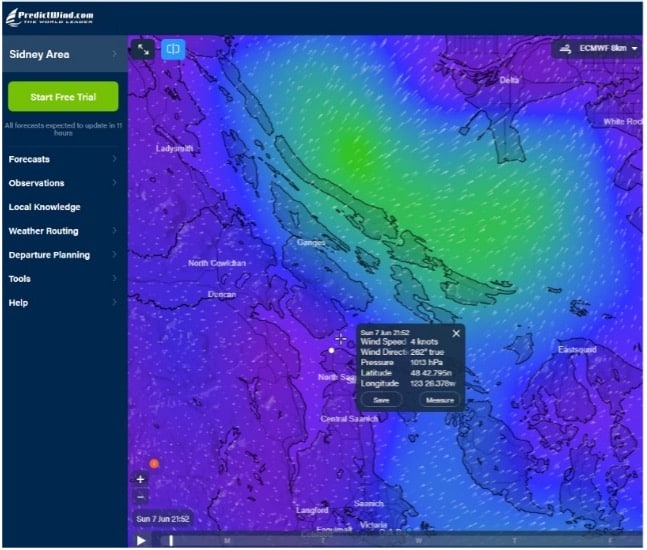
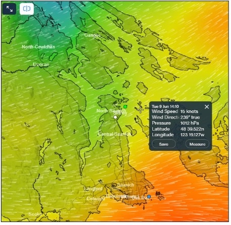
A list of wind prediction apps can be found on SISKA’s (South Island Sea Kayaking Association) general website. They all provide excellent information. Choice of app depends on personal preference as well the information each app provides on the areas where you plan to paddle. While a discussion on wind apps alone could take several pages, here is a very brief introduction. Two popular choices for our area are Windy and PredictWind both of whom provide multiple forecast models in graphic display with colour coding as well as in table format (see screenshots below from PredictWind). Taking time to familiarize yourself with these Apps and the wealth of information they provide is well worth the effort. The key pointers to look for is speed and direction of wind but also gusts (circled in table). The latter is particularly applicable to the Satellite Channel where sudden, unwelcome gusts can descend without warning.
 Screenshots from PredictWind
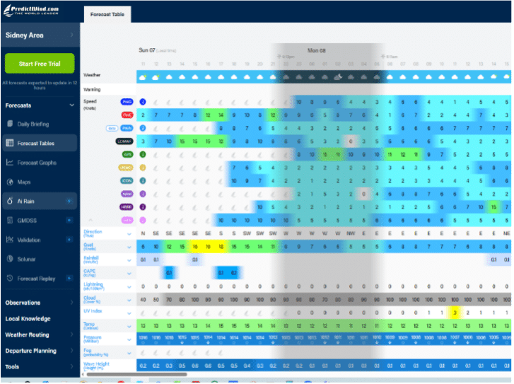 Screen Shots from PredictWind
Today as I write this, it is a beautiful calm morning with relatively little wind in the Satellite Channel. I am tempted to head down to Moses Point and jump into my kayak for a gentle shoreline paddle, perhaps out towards Piers Island and be back for lunch. Even though the current is against me at about 1.5 kt. (that’s doable and I can catch the shoreline eddies) I would rather have the current on my side on the way home.
However, I check my apps and see winds in the Sidney/North Saanich area are predicted to be 15 kt from the southwest by noon with potential gusts up to 26 kt. Here is what a challenging paddle home looks like on PredictWind on the day and the change on day after:
 Screen Shots from PredictWind
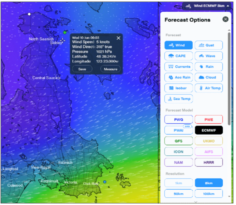
Luckily, if I were to start my homeward journey before noon, I would have the current on my side, but that would be small compensation for the strong winds and potential nasty gusts. Alternatively, I could paddle with the current in the opposite direction towards Towner Bay and have the wind at my back on the return journey. But I had better be careful to keep my distance from the rocks so that I don’t get blown into them and be prepared for a potential surf landing around the rocky shores of Moses Point.
I think I should stay home and write this article…
What to Know: Tides & Currents
Consulting tides and currents tables is the next essential element in deciding when and where to head out for a paddle. Though both phenomena are linked they are not the same. In a nutshell, tides rise and fall (insert up and down arrows) and are caused by the moon’s gravity while currents are the directional ebb and flow of flood of water (insert horizontal directional arrows). While tides do influence the currents, other complex factors play a part such as geography (water flowing around islands and through narrows), harbours, inlets, river flows and much more. Luckily, we don’t need to do in-depth scientific study as we have handy apps that will provide the information we need. The wise kayaker will plan accordingly, soon realizing that paddling against a current requires more effort than the speed of the current indicates (a 3-4 knot current can feel overwhelming to even strong paddlers) while the opposite is true when paddling with the current (your normal speed is increased by sometimes double). Tides and currents are entirely predictable which is great for planning, however winds are not and can scupper the best made plans.
Designing your paddle around currents, even a short one, is not only highly recommended but a guarantee of a more enjoyable, stress-free experience. There is no shortage of websites and apps that provide the information you need. For a local half day or day paddle around the North Saanich/Sidney area, consulting one or two from the options below is sufficient.
One of the more popular Apps for tides and currents (there are many) is AyeTides which is designed primarily for mobile devices. It offers tide and current information in easy-to-read visual formats to most locations worldwide and functions offline.
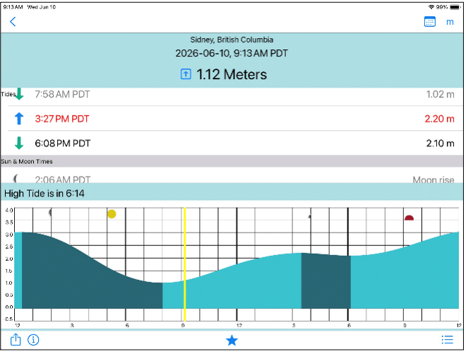
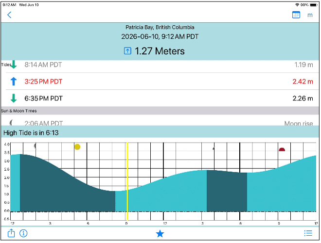 Screen shots of Tides and Currents from AyeTides:
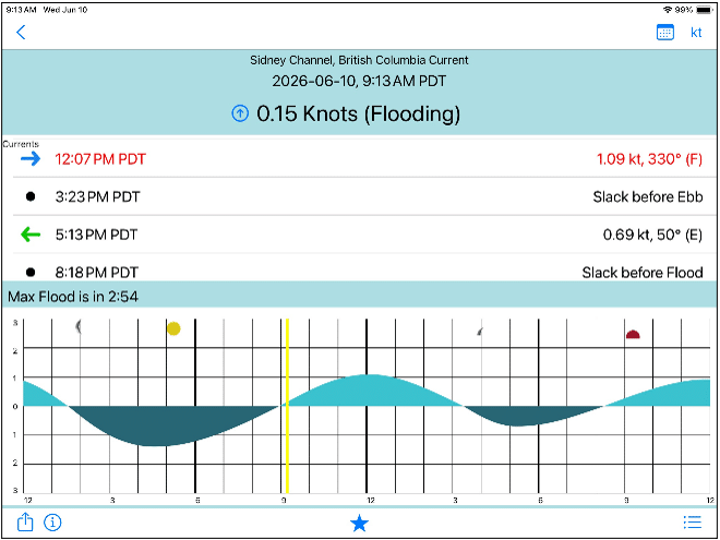 Screen shots of Tides and Currents from AyeTides
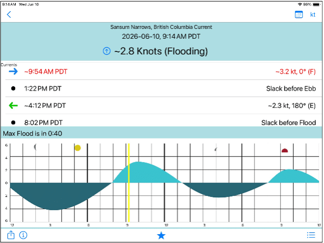
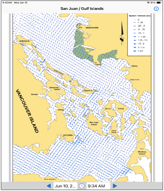
Another currents resource for the Salish Sea is the Current Atlas for Juan de Fuca Strait to Strait of Georgia. Using this valuable resource in its original format requires looking up year, date, time and working through tables. Thankfully, a handy workaround has been developed for mobile devices: the PNW Current Atlas for iPhones and iPad as well as Android phones and tablets.
Ocean Connect, funded through the Tula Foundation and maintained by the Hakai Institute, is a locally developed, free platform featuring a website and mobile App, focused on exploring forecasts and conditions along the coast of British Columbia. The website is exceptionally user friendly, providing valuable information on tides, currents, winds, waves, weather and more in graphic as well as chart form. Predictions are limited to a three-to-four-day range, so I like to use AyeTides and at least two wind apps when planning more than a few days ahead and follow up with Ocean Connect to compare/confirm closer to the day.
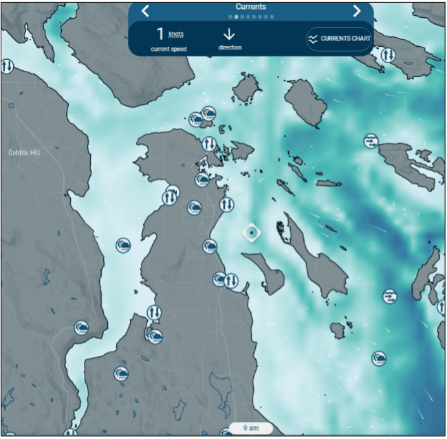 Screen shots from OceanConnect Currents Page
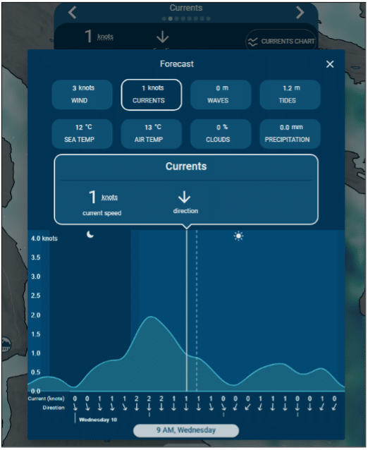
Additional links to tides and currents information can be found on SISKA’s general website.
Where to Go: First Steps
What about spontaneity you might say? Doesn’t all this planning take the fun out kayaking? Once you become familiar with a few simple Apps and practice using them, it is easy to do a quick check before jumping into that kayak, even at the last minute. One way of looking at it is to take joy in becoming more involved with our environment by familiarizing ourselves with the movement and moods of the waters, winds and weather. As you drive by Patricia Bay or walk along the Sidney waterfront, look at the sea state, at the wave height, the movement of the waves, whether there are whitecaps. Then practice using your Apps and compare what you see with your digital information.
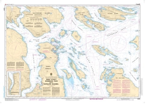
The best way to start your coastal exploration is to decide on a launch spot and do exactly that. A marine chart (number 3441, available from All Bay Marine in Sidney) is your ideal guide for navigating the coastline.
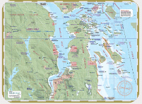
Another option for a casual paddle that is not an expedition, is the Saanich/Sidney ‘Deck Topper’ mapsheet available from Wild Coast Publishing.
The North Saanich Currents Team has mapped 27 beach accesses with photos and information but many, with rocky shores and steep or winding stairs, are not ideal for launching kayaks.
Some good locations on the west side of the peninsula for first time paddles are:
- Chalet Beach at the end of Tatlow Road; Launch site information can be found here
- Briarwood Beach Access; Steps down to a sandy/gravel beach
- Coles Bay; Launch site information can be found here
- Patricia Bay North; Launch site information can be found here
- Patricia Bay South; Launch site information can be found here
- Moses Point; A popular choice despite its difficulties. Launch site information can be found here
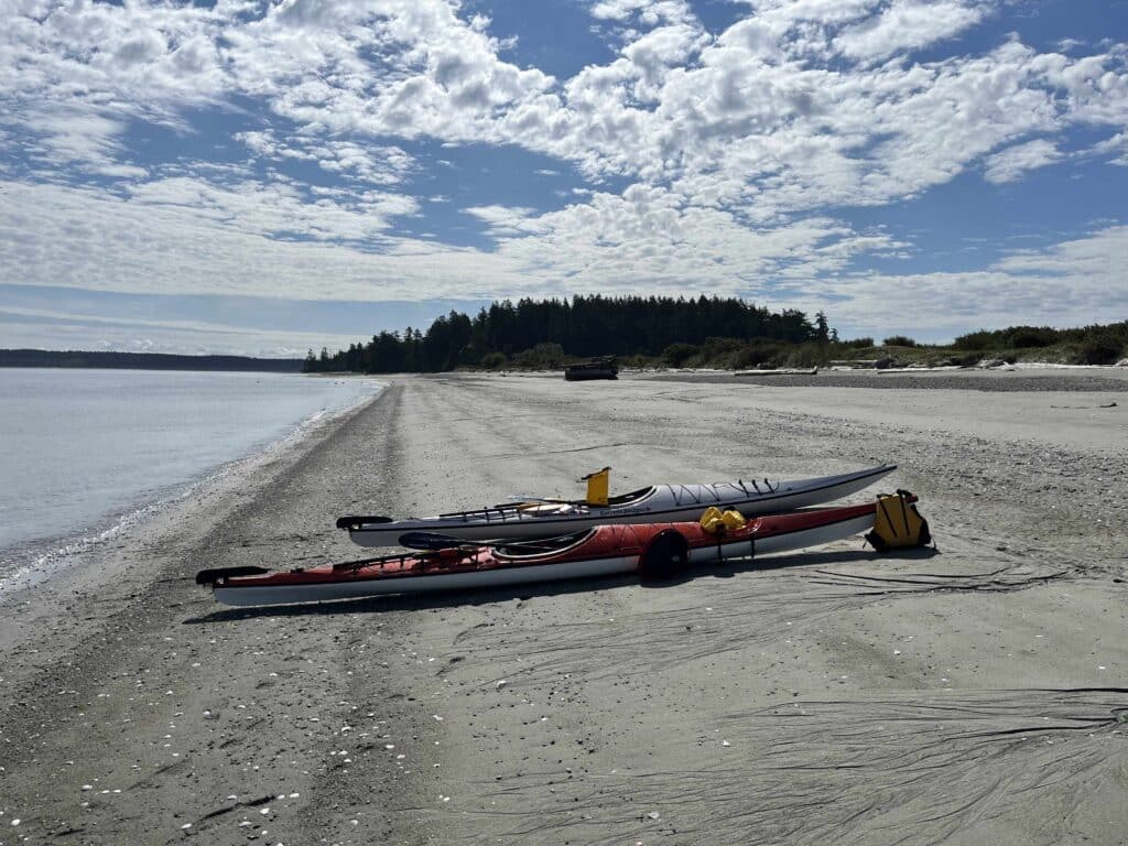
My recommendation for a very first paddle (on a calm day) is Briarwood Beach Access or Cole’s Bay. From either location, a pleasant shoreline paddle heading north towards Patricia Bay or south towards Thompson Cove is an ideal start to exploring the delights of the North Saanich coastline. Paddling from Moses Point following the shores of Deep Cove to Coal Point or Towner Bay is equally rewarding. Heading in the opposite direction from Moses Point following Lands End Road can provide interesting real estate viewing! A note of caution: Avoid being tempted to cross the channel to Salt Spring Island. The distance is longer than it looks and should only be attempted by the experienced paddler with training in sea kayaking skills (see Paddle Canada Sea Kayak Program for progression of skills development).
One last note of caution and of utmost importance, never paddle alone and always inform a family member or friend of your plans. In kayak language, we call this a float plan.
Belonging to a Kayaking Organisation
Finally, the benefits of belonging to a kayaking club or organisation cannot be overstated. Victoria is home to several outstanding paddling clubs with the largest and most active purely dedicated to kayaking being the South Island Sea Kayaking Association (SISKA). Belonging to a club is the most effective way to learn skills from basic to advanced as well as develop awareness of safety on the water – and it has the added advantage of developing a social network of paddlers. SISKA offers over seventy organized group paddles with experienced leaders annually as well as skill building workshops. Victoria Canoe and Kayak Clublocated on Gorge Road, also offers skill building opportunities and is a great place to start if you do not own your kayak.
Look forward to seeing you OTW (safely) this summer!